Rare Cartography Books
Displaying books 21 - 40 of 195 in total
$500.00 Online price
Original engraved hand-coloured map of America showing the islands of the Great Pacific Ocean or South Sea.
Published: 1843
Stock No. 248245
$500.00 Online price
$200.00 Online price
A Complete and Universal English Dictionary; including not only an Explanation of difficult words and technical terms, ...but also a Pronouncing Dictionary, ...
Published: ca. 1828
Stock No. 248042
$900.00 Online price
An Atlas of Classical Geography containing 24 maps; constructed by Wm. Hughes. ...
Published: 1864
Stock No. 248018
$150.00 Online price
Original hand-coloured engraved map of the County Palatine of Durham, is most respectfully dedicated to the Nobility, Clergy, Gentry, &c. &c. by their most obliged and very humble servant, the Proprietor, William Colling Hobson.
Published: Circa 1840
Stock No. 247971
$350.00 Online price
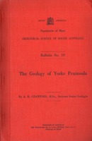
Original engraved map of Africa with the latest Discoveries. Hand-coloured in outline showing the Island of Madagascar in the Eastern Indian Ocean, as well as the Ethiopic or Southern Ocean.
Published: 1843
Stock No. 248247
$300.00 Online price
The Principal Navigations Voyages Traffiques & Discoveries of the English Nation. Made by Sea or Over-land to the Remote and Farthest Distant Quarters of the Earth at any time within the compasse of these 1600 Yeeres. 12 vols. Complete.
Published: 1905
Stock No. 247882
$600.00 Online price
Matthew Flinders: Navigator and Chartmaker. Foreword by H.R.H. The Prince Philip, Duke of Edinburgh.
Published: 1986
Stock No. 248883
$175.00 Online price
Magalhaes-Strasse und Austral-Continent auf den globen des Jonannes Schomer.
Published: 1967
Stock No. 244586
$45.00 Online price
$55.00 Online price
The Mapping of Australia. With an index compiled by Douglas Matthews.
Published: 1979
Stock No. 241531
$300.00 Online price
Landmarks of Mapmaking. An Illustrated Survey of Maps and Mapmakers. By C. Bricker. Preface by G.R. Crone.
Published: 1976
Stock No. 241948
$185.00 Online price
Decorative Printed Maps of the 15th to 18th Centuries. A revised edition of Old Decorative Maps and Charts by A. L. Humphreys. ...
Published: 1966
Stock No. 242182
$45.00 Online price
The Voyage of Torres. The Discovery of the Southern Coastline of New Guinea and Torres Strait by Captain Luis Baez de Torres in 1606.
Published: 1980
Stock No. 241390
$55.00 Online price
